all Travel Business All Travel Businessall Travel Business

Search This Blog

Pages

Showing posts with label Mountain. Show all posts

Mt. Kanchenjunga - Trekking and Expedition

(for more pictures click Mt. Kanchenjunga...)
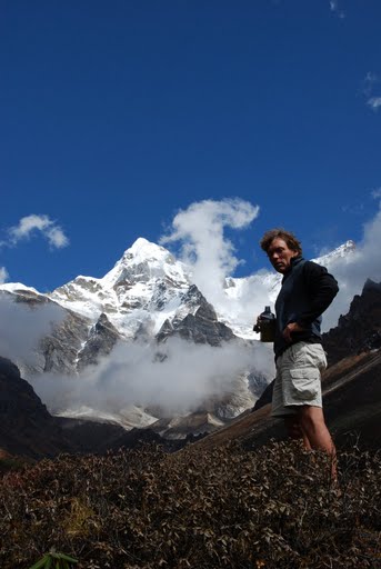
Mount Kanchenjunga, one of the world's most spectacular mountains, is renowned as the queen of mountains. Kangchenjunga, the third highest peak on the planet, can boast of varied ecological zones, from the subtropical land to glacial wilderness. Mighty Kangchenjunga glacier is the most famous attraction of Kanchenjunga. Great valleys, encircled by high peaks, are another feature of Kanchenjunga. Mt. Kanchenjunga is a massif with its highest peak reaching 8,586metres. It is encircled with dozens of peaks, each of them competing with their queen. 


It is situated in eastern part of Nepal at 8598m. It was first climbed by a British team in 1956. It is an enormous mountain mass, and many satellite peaks rise from its narrow icy ridges. It is located on the border of Nepal and Sikkim, just 46 miles northwest of Darjeeling. It is the most easterly of the great 8,000 meter peaks of the Himalaya. The peak consists of four summits.


The west summit, Yalung Kang, is 8420m high and some people classify it as a separate 8000m peak. Three first Westerner to explore Kanchenjunga was the British botanist JD Hooker, who visited the area twice in 1848 and 1849. Exploration of the Skim, side of the peak continued with both British and pundit explorers mapping and photographing until 1899. In that year a party led by Douglas fresh field made a circuit of Kanchenjunga and produced what is still one of the most authoritative maps of the region. The Japanese now took up the challenge and mounted expeditions in 1973, 1974 and 1976 during which they climbed Yalung Kang. A German Expedition climbed Yalung Kang in 1975, and in 1977 an Indian army team mounted the second successful expedition to the main peak of Kanchenjunga.

view of kanchenjunga


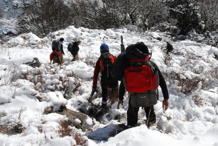
The route (North Face) is definitely the safest, although not the easiest. Climb of Kanchenjunga begin from a charming base camp in the meadows of Panorama at 5,180 m. First challenge is to fix lines up 900 m of intricate mixed climbing to the North col. This provides the most challenging climbing of the expedition. Once creating a lifeline to and from the North Col you can begin the long process of establishing three camps up the long and complicated North ridge. Using Sherpa support and oxygen, you can move at a systematically slow velocity higher and higher up the mountain. This is a highly satisfying climb for the expert Climbers.

Fast Facts
LocationFar-east Nepal
Altitude8,586 metres (28,169 feet)
Significance3rd Highest Peak in the World
SeasonSeptember to December, early February to late June
Peaks
  • Kangchenjunga Main (8586 m/ 28,169 ft)
  • Kangchenjunga West (Yalung Kang) (8505 m/27,904 ft)
  • Kangchenjunga Central (Middle) (8482 m/ 27,828 ft)
  • Kangchenjunga South (8494 m/ 27,867 ft)
  • Kangbachen (7903 m/ 25,925 ft)


Trekking Route To Kanchenjunga
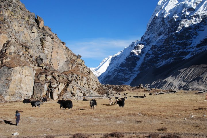
The long trekking trail to Kangchenjunga takes one through some of the country's most pristine forests. The region is an ideal place for the tourists who desire for some time in seclusion. The following is a possible day-to-day trek to Kanchenjunga.

Day 01: Fly from Kaathmandu to Birathagar/ drive to Basantpur (2200m)

Day 02: Trek to Chauki (2700m)

Day 03: Chauki / Gupha Pokhari (2930m)

Day 04: Gupha Pokhari/ Nisum (2000m)

Day 05: Nisum / Dovan (921m)

Day 06: Dovan / Chirwa (1270m)

Day 07: Chirwa / Sekhathum (1660m)

Day 08: Sekhathum / Amjilassa (2510m)

Day 09: Amjilassa / Kyapra (2730m)

Day 10: Kyapra / Ghunsa (3595m)

Day 11: Ghunsa rest

Day 12: Ghunsa / Khambachen (4040m)

Day 13: Khambachen / Lhonak (4785m)

Day 14: Day trip / Pangpema

Day 15: Pangpema / Khambachen

Day 16: Khambachen / Ghunsa

Day 17: Trek around Glacier (up to 5540m, if you want) / high camp

Day 18: High camp / Ramche

Day 19: Ramche / Tseram (3870m) back to Ramche

Day 20: Ramche / Amchekhola

Day 21: Amchekhola / Ponphe

Day 22: Ponphe / Kande Bhanjyang

Day 23: Kande Bhanjyang / Lal Kharka

Day 24: Lal Kharka / Taplejung

Day 25: Taplejung / fly Kathmandu /transfer hotel

Highlights 
Although the whole trekking trail to Kanchenjanga is adventurous and brimming with thrill, there are certain spots which are unmissable. Few of them are cited below:
  • Wonderful glaciers to trek like Yalung Glacier
  • High challenging mountain passes
  • Rhododendron forests
  • Opportunity to meet native Nepali communities such as Sherpa, Limbu, Rai and Gurung

Tit Bits 

  • Kanchenjunga is less explored by foreign visitors and lies shrouded in mystery.
  • Some features of the walk are pleasant villages in the high regions, glorious mountains and abundant wild life.
  • The wildlife at Kanchenjunga includes musk deer, blue sheep and for the believer, the Yeti!
  • Magnificent views of Mt. Everest, Makalu and Kanchanjunga massif make the trip memorable.
  • Soaring peaks, the Yalung Glacier and a wide variety of natural vegetation and agriculture areas can be seen in this region.
  • Kanchenjunga is located in the extreme northeast corner of Nepal bordering Sikkim (an Indian state) to the east and China to the North.

How To Reach The trek to Kanchenunga begins at Tumlingtar or Taplejung that is accessible by air or by road through Ilam or Basantpur.


My Zimbio

Mt. Makalu Expedition and base camp trekking

(For more pictures click Mt. Makalu... )


Mount Makalu (8463m.) was first climbed by a French party in 1955. The peak was first mapped and photographed from the Tibetan side by the 1921 British Everest reconnaissance. Hillary and Shipton photographed mount Makalu during a side trip on the 1951 Everest reconnaissance. Hillary and others approached the peak a year later after the failure of their mount Cho Oyu expedition.

The first attempt on mount Makalu was in 1954 by a US team, mostly from California , who trekked all the way from the Indian border near Biratnagar. At the same time a British team approached the mountain, but this expedition was abandoned when Hillary became seriously ill and had to be evacuated.

In the autumn of 1954 a French team attempted the peak. In the following spring, successfully ascents were made by three teams of French climbers on successive days.

In 1960 a large scientific and mountaineering expedition wintered at the foot of mount Ama Dablam, occupying the Green and Silver buts. In May 1961, the expedition trekked across the Mingbo La and other high passes to the foot off mount Makalu , where they planned to climb the French route, Sickness stopped the expedition, which became a heroic struggle for survival.


The Japanese climbed mount Makalu in 1970, another French team climbed it in 1971 and a Yugoslav expedition reached the summit in 1975. In 1976 Spanish and Czechoslovakian teams joined up near the summit.


Makalu West Face

It is very adventurous route to climb because it is a little bit dangerous as well. The 5 attempts were made before climbing this Mount Makalu Mountain ; then only it was succeeded in the final.

The West Face was successfully summit in 1997. The Russian expedition had taken the route of this West Face of mount Makalu, leaded by Sergey Efimov and climbed the top on 21st of May via the most difficult route. The last part of the route had gone on Parago ridge. Alexei Bolotov, Yuri Ermachek, Dmitri Pavlenko, Igor Bugachevski and Nikolai Jiline had climbed on the top of mount Makalu at this time For this ascent they were awarded the "Gold ice-axe".


The routes are of 4 parts: 

The bottom part starts from the base of the West Face at 5,800 meters and climbs to the hanging ice-fall at 6,100 meters to the right part of the ice-fall. The second part extends from the plateau above the ice-fall along 35 to 45 degree elevation's rock up to the 6,500 meters high. The next section is an ice-rock wall, 50 to 55 degrees steep and that extends to 7,400 meters height. The last final section begins 70 to 75 degree elevation's rock pillar, which leads to the west ridge at 8,000 meters height till to the top of the summit.

Ropes are typically fixed from 5800m to 6100m and from 6500 m to 7500m. Camps established by the Russian Team were at the following locations.

The French Route on the West Pillar is an aesthetically stunning line that has been seldom attempted. It is an exceedingly difficult, a very steep pillar that was first successfully ascended in 1971. The crux of the line comes at approximately 7,600m in the area of the Seignior Wall.

The first US team to summit was in 1980, they summit via this West Pillar Route . The team was made up of Jim States , John Roskelley, Kim Momb and Chris Kopczynski. They summit 2 members of the team and put 2 members within 150 feet. They summit without the use of oxygen or Sherpa support.


Itinerary


Fly to Tumlingtar
Tumlingtar - Kuwapani
Kuwapani - Chichila
Chichila - Num
Num- Seduwa
Seduwa - Tashigaun
Tashigaun - Khongma La (Danda)
Khongmadanda - Mumfuk
Mumfuk -Yangle Kharak
Yangle Khark -Merak
Merak -Sersung (half day rest) for acclimatize
Sersung - Makalu Base camp
Climbing Period for Makalu 8463m.
Makalu BC - Mumbuck
Mumbuck - Khongma La (Danda)
Khongma La - Seduwa
Seduwa - Chichila
Chichila - Tumlingtar
Tumlingtar - you can take the flight from here

Source: - http://www.everestguides.com/expedition-in-nepal/makalu-autumn-season.php


Mt. Makalu and Surroundings

My Zimbio

Followers