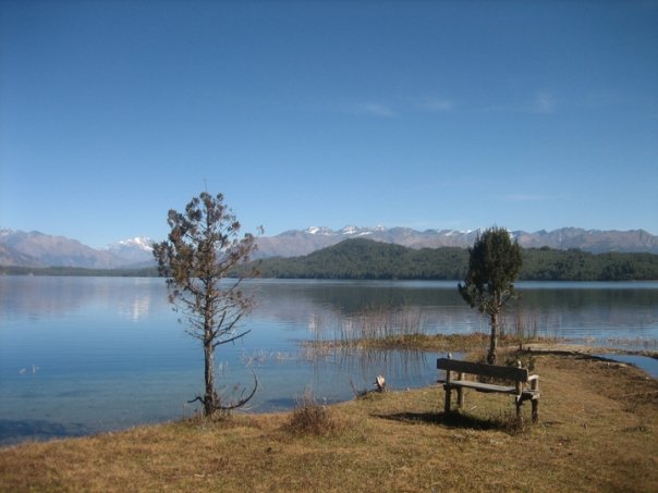
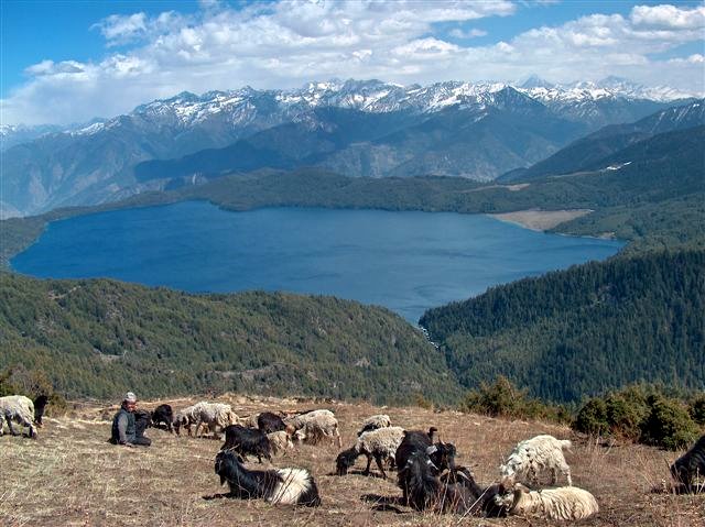
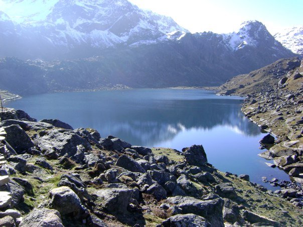
(for more pictures click Tilicho...)
The Route
The Tilicho Tal route between Manang and Marpha is a spectacular but much tougher alternative to the standard Thorung La route. In the past this trek has been considered off limits, being part of a military training area.
The Tilicho Tal route between Manang and Marpha is a spectacular but much tougher alternative to the standard Thorung La route. In the past this trek has been considered off limits, being part of a military training area.
However, recently it was realized that the restrictions apply only to part of the area and so it is still possible to trek there without entering the restricted region. Very few people realise this.
The route crosses three 5000+m passes and requires two to three nights camping. The trail itself is infrequently used and traverses some difficult terrain including steep, unstable scree slopes. On the Manang side the trails to the lake are gradually being improved and there is a semi-operational lodge at the base of the first pass meaning that you could visit the lake as a side-trip without camping. This side trip provides good acclimatization for crossing the Thorung La.
Which route - Thorung La or Tilicho?
Tilicho is a far more committing route. Experience-wise, they are different but, much as I hate to admit it, both are equally spectacular. So essentially Tilicho has extra kudos among discerning trekkers and the "I did it different" factor but Tilicho does mean camping so it is more of a remote wilderness experience.
Acclimatization
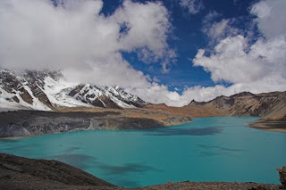 Because you have to sleep at 4900m you need significantly more acclimatization than for the Thorung La route (where you sleep at a maximum of 4200m, at Thorung Phedi, or 4600m at the new Thorung Phedi Base Camp lodge). Your acclimatization, at an absolute minimum, should include staying the night at either Ghyaru or Ngawal (staying at both is far better) on the high route from Pisang to Manang, a night each at Manang or Khangsar and the gompa above Khangsar before staying at Meadow Camp. Even then you are only acclimatized to sleeping at around 4300m and jumping to camping by the lake shore at 4900m will be uncomfortable for some people. Carry Diamox and consider using it from Meadow Camp.
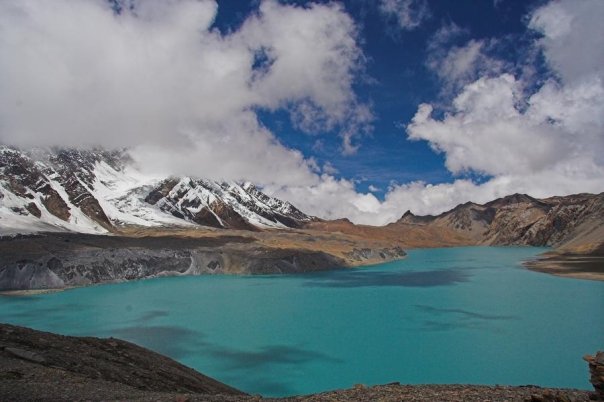
For some acclimatization and a view of the route climb to the two lakes high above Manang. Herzog crossed on the frozen lake (and had fun persuading his porters) to save the arduous higher route around. From late December the lake is frozen enough to cross, with care!
Gear

Names
Cho or Tso means lake so it is redundant to call it Tilicho Lake. The locals don't call the route Tilicho La, although this is a possible name for the route. More than this, I haven't yet found out.
Seasons
This is route should only be attempted when mainly snow-free and during fine weather, ie October to late December and perhaps May - June. If the winter snows have been light then trekking across in January to April may be possible if exceptionally well prepared for snow and cold.
Trail Notes
To Manang
 See Trekking in the Annapurna Region or other trekking guides. Allow 6 to 8 days from Kathmandu.

Day Trips from Manang
There are a number of good day trips out of Manang to aid acclimatization but the best isn't mentioned in the guide books. Only attempt this in good visibility since there is no major trail.
There are a number of good day trips out of Manang to aid acclimatization but the best isn't mentioned in the guide books. Only attempt this in good visibility since there is no major trail.
The Lakes above Manang
From Manang take the trail in the direction of Braga. Leave this trail after crossing the first stream out of Manang. Head up the ridge on steep trails past a gompa and other buildings. Continue heading up on vague trails. there is a kharka, a collection of stone shacks part way up, although you may miss these. Continue up, bearing slightly right, if in doubt. You don't want to follow or get close to the stream that you first crossed, just out of Manang. Bear right (north) and eventually come across a small lake, really a pond and a kharka. The route is more obvious now. From the second, larger lake climb the spur to the right for fabulous views.
From Manang take the trail in the direction of Braga. Leave this trail after crossing the first stream out of Manang. Head up the ridge on steep trails past a gompa and other buildings. Continue heading up on vague trails. there is a kharka, a collection of stone shacks part way up, although you may miss these. Continue up, bearing slightly right, if in doubt. You don't want to follow or get close to the stream that you first crossed, just out of Manang. Bear right (north) and eventually come across a small lake, really a pond and a kharka. The route is more obvious now. From the second, larger lake climb the spur to the right for fabulous views.
Khangsar ~ 3800 m
There are two routes to Khangsar. The more usual route is part way through Manang descend to the bridge that crosses the Marsyangdi but stay on the Manang side and head up-river past where the Khangsar Khola enters and cross on the bridge there. After an initial steep slope there's a broad track to Khangsar.
There are two routes to Khangsar. The more usual route is part way through Manang descend to the bridge that crosses the Marsyangdi but stay on the Manang side and head up-river past where the Khangsar Khola enters and cross on the bridge there. After an initial steep slope there's a broad track to Khangsar.
ALWAYS ask local advice for the trail up to Tilicho, and ask if the lodge is open or if someone can come up. Leaving Khangsar again there are two routes, the higher more torturous trail via the Gompa which begins at the far end of the village and the lower, easier route that descends to the river from the centre of the village. The lower route provides less acclimatization and you should check with locals that the bridges are in place, and if not, you must take the high route.
Note
The lower route is not the safer and the trail doesn't stay on the Khangsar side of the khola (stream). You must cross! This trail on the other side is being developed.
The lower route is not the safer and the trail doesn't stay on the Khangsar side of the khola (stream). You must cross! This trail on the other side is being developed.
Meadow cap ~4200 m
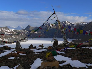 (I didn't find the traditional name for this area). Traditionally a summer grazing area, in 1994 the beginnings of a lodge were built here. In fall 96 two ladies from Khangsar spent the season up here. They provided simple food but no bedding or mattresses. As this side trip becomes more popular more facilities will be provided. In 1999 the lodge was still little developed but the locals were getting more serious about building a lodge at Tilicho itself, which means the meadow lodge would be vital to the plan.

Around here and higher you can find blue sheep grazing. It is also snow leopard territory. I was lucky enough to see one here while sleeping out on a small knoll. It walked along the trail, within 10m of me!
An obvious path leads to the zig-zag route up the huge moraine. Part way up the route divides, although the cairned junction is easy to miss. The route straight up is steeper and now disused. The other path contours up to a slightly lower pass, a slightly longer route. Over the crest is the lake framed by the impressive Tilicho Peak 7134m. Both trails are exposed and steep. If thickly covered with snow it is mountaineering terrain and the avalanche risk is correspondingly high.
Tilicho Lake 4900 m
 It is an area of rough and wild beauty. The 4km by 1km lake rests at 4900m. There is no visible outlet, a fact that has confused Kathmandu map makers. The southern shore is a glacial wall pushing in from the south, while a segment of the north shore is a magnificent sheer cliff.
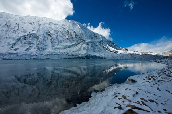
Once tourism becomes more sophisticated sea kayaks would the ideal method of crossing the lake and eyeballing the glacial walls, Alaskan style.
Despite the dotted trails on most maps you CAN'T walk around the northern shore of the lake unless you can walk on water or ice. Never attempt to traverse the southern shore-glacier under Tilicho Peak, although there is a faint trail - it's raked by avalanches and is particularly rough country. At least one trekking party has had people die here.
If camping near the shore make a deep toilet (ie half a metre for 5 trekkers) well away from the lake (100m or more) and cover with heavy stones on leaving. This region was still pristine in fall 1996. Please personally double-check that you or your crew have left your camp site so clean that you wouldn't know anyone had stayed there.
From around the middle to late December into May the lake is frozen enough to walk on, but test the thickness well away from the shore. 100mm should be considered the minimum, although in theory 40mm can support a dog team and sled. When crossing don't stick to the shore since rocks occasionally put holes in the ice there and the sheer rock wall reflects sunlight, leaving the ice weaker near it. Note also that ice thickness will vary so be particularly watchful early and late in the season. Once across ascend the obvious gully to meet the alternative pass trail.
view of Tilicho LakeThe pass to the north ~ 5300 m
When the lake isn't frozen or your nerves aren't up to it, the alternative is to cross another pass. From near the lake head north-east up to the small but obvious notch, and to new vistas. There is no path from here, only a few cairns but the route is straightforward enough. Over the minor pass eventually head down a large gully (good scree-running) that leads to the other end of the lake. Well into this gully some paths sidle off to save descending the last part although staying on the valley floor may be easier.
When the lake isn't frozen or your nerves aren't up to it, the alternative is to cross another pass. From near the lake head north-east up to the small but obvious notch, and to new vistas. There is no path from here, only a few cairns but the route is straightforward enough. Over the minor pass eventually head down a large gully (good scree-running) that leads to the other end of the lake. Well into this gully some paths sidle off to save descending the last part although staying on the valley floor may be easier.

Further down are shepherds camps and a good trail to Thinigoan, visible from the pass region.
Suggested Itinerary
From Pisang village: Pisang village 3200m (lower) 3300m (upper) Ghyaru 3670m and/or Ngawal 3657m Braga 3450m or Manang 3540m Optional extra day at Braga or Manang Khangsar ~3800m Khangsar gompa ~4000m Meadow Camp ~4200m Lake camp 4900m Kharka camp Marpha/Jomsom
From Pisang village: Pisang village 3200m (lower) 3300m (upper) Ghyaru 3670m and/or Ngawal 3657m Braga 3450m or Manang 3540m Optional extra day at Braga or Manang Khangsar ~3800m Khangsar gompa ~4000m Meadow Camp ~4200m Lake camp 4900m Kharka camp Marpha/Jomsom
Source: - "TRAILBLAZER" book by "Jamie McGuinness"